
The carbon isotope ratios of atmospheric CO2 reflect a balance between source (respiration, anthropogenic activities, fires) and sink (photosynthesis) processes. As turbulence dominates the mixing of CO2 in the atmosphere, the distribution of [CO2] values within and above the convective boundary have been used for scaling carbon cycle activities. Here stable isotopes play a role constraining interpretations on the role of fluxes at large scales. Typically, Keeling-plots are used to characterize terrestrial fluxes. The utility of carbon isotopes in CO2 is to constrain interpretations of what is driving changes in biosphere-atmosphere CO2 estimates (net ecosystem exchange, NEE). Increasingly, atmospheric models (e.g., WRFF, STILT) can be combined with concentrations and carbon isotopes in CO2 to make predictions of fluxes and to dissect out the sources contributing to these fluxes.
The project will support a postdoc to compile and synthesize the data from published Keeling plot studies and local to global-scale monitoring networks to elaborate the role of isotopic data in describing CO2 flux attribution and ecosystem-level gas exchange over multiple spatial scales. Data anlaysis will involve significant quantitative work with a number of ecosystem, atmospheric, and chemical transport models.
Several initial projects are anticipated:
Bowling, Ehleringer, Gurney, Pataki, Randerson, Wofsy
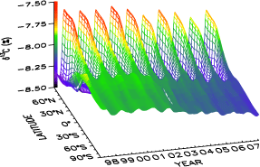
Image courtesy of the Institute of Arctic and Alpine Research, University of Colorado, and NOAA Global Monitoring Division
![]()
IsoMAP is a dynamic, online workspace for spatial analysis, modeling and prediction of stable isotope ratio variation in the natural environment. Visit IsoMAP to learn more or to start making isoscapes today!